Technology Solutions | Change Initiatives
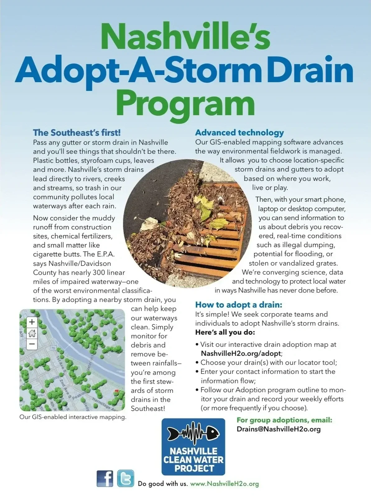
Technology is good for more than just websites and workflow. We deploy it to solve real world problems. Here’s how our GIS-enabled mapping platform advanced the way environmental fieldwork was managed, recorded and protected local waterways in a manner the South had never done before.
The Challenge
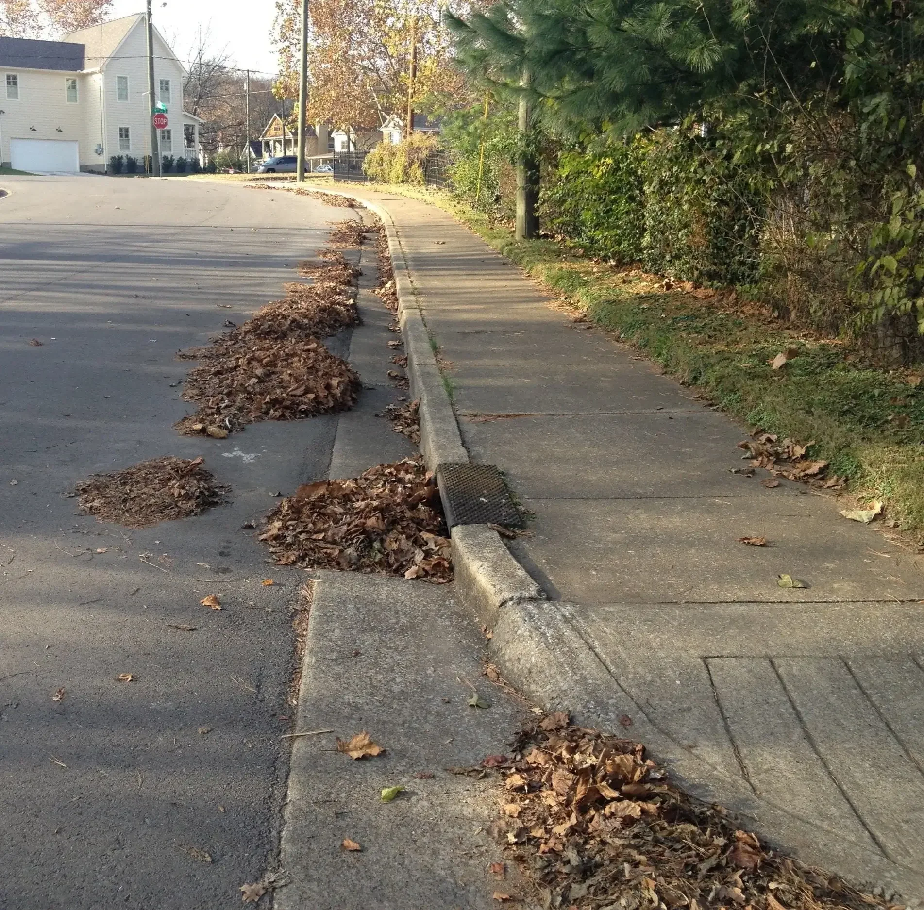
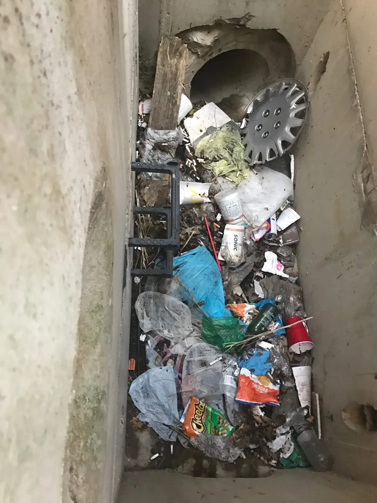
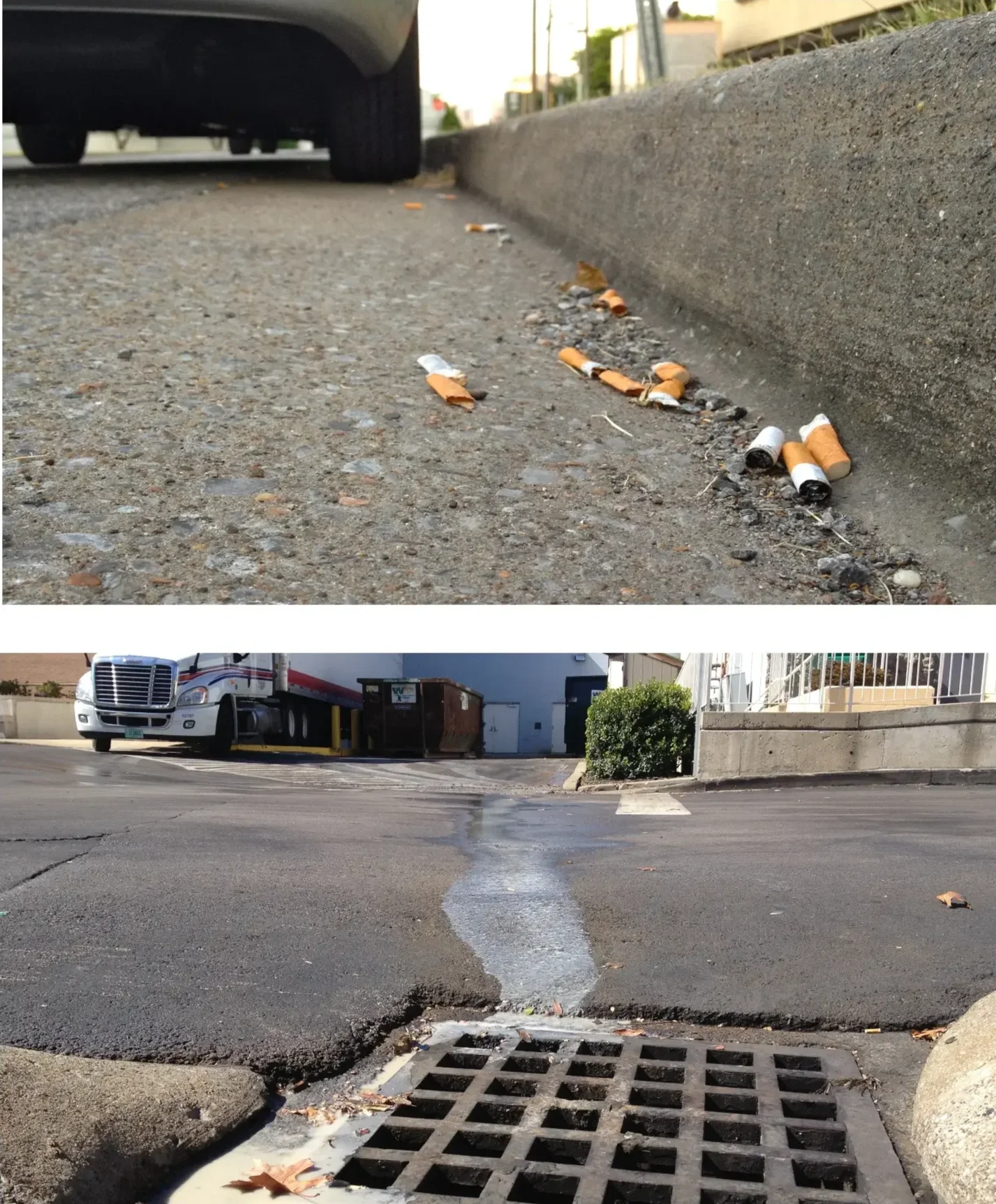
The Federal EPA had declared nearly 1,000 miles of Nashville area waterways “impaired” – among the worst environmental classifications possible — and that remained unchanged more than a decade later. While the source points of this problem were myriad and complex, a few were fairly obvious and approachable: An unmanaged development community largely ignored erosion control on their construction sites, and a rapidly growing, careless urban population was discarding cigarette butts, plastic bottles, polystyrene, and more into Nashville’s gutters and storm drains. Those drains lead directly to rivers, creeks and streams, so all these pollution and erosion violations contributed heavily to the problem.
A new nonprofit emerged with an innovative idea to engage everyday citizens in part of the solution: a technology rich Storm Drain Adoption programs. At time, about a dozen such adoption programs existed across the country — only a few integrated technology, none in the Southeast. It was our job to figure out how.
Our Approach
As many nonprofits do, this one operated on a refined budget so our first requirement involved developing a robust technology stack that wouldn’t break the bank. The ambitious stack also needed to accommodate numerous community stakeholders and non-technical public users, automatically process and post unique data updates, collect and parse inbound data from adopters, integrate with existing websites, databases and SaaS products, and ultimately recall and render specific data as a visualization tool.
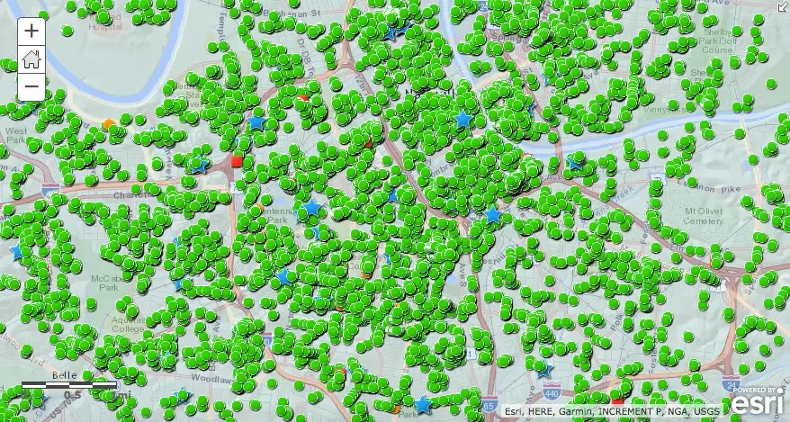
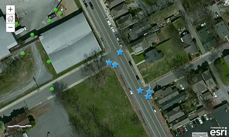
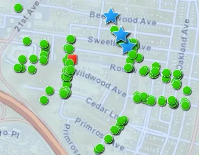
After considering many options, we developed a Global Information System (GIS)-based web portal with highly customized code that enabled location-based analyses and contextual imaging. We then integrated a tailored data collection systems, and enabled mass mapping uploads from the local Water Department and individual contributors. Soon, volunteers would be using smart phones, tablets, laptops or desktop computers to adopt a drain based on the precise location they worked, lived or played.
Our Results
We set out to create a technologically advanced stewardship program, and achieved just that with the first GIS-enabled system in the Southeast U.S.
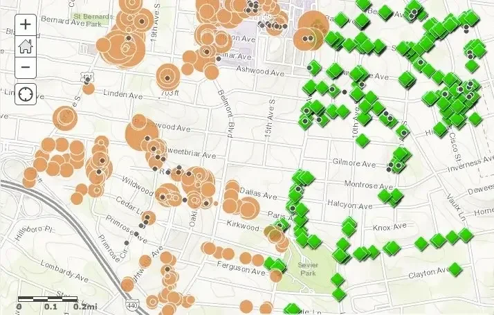
After an initial pilot confirmed our technology assumptions, UX and software integrity, the program launched across 526 square miles of Nashville, incorporating 44,000 interactively mapped storm drains and inlets. Suddenly, residents were connected to thousands of environmental stewardship opportunities just yards away.
With an assortment of reporting options, volunteers could submit real time conditions on precise drain locations, including source point pollution, flood risks, jeopardized equipment/grates, and more. Altogether, multiple thousands of data points were collected from hundreds of volunteers, most of whom adopted multiple drains at one time. The program was ideal for individuals and families, as well as church groups, scout troops, neighborhood associations, schools and larger entities who looked to protect entire streets or blocks.
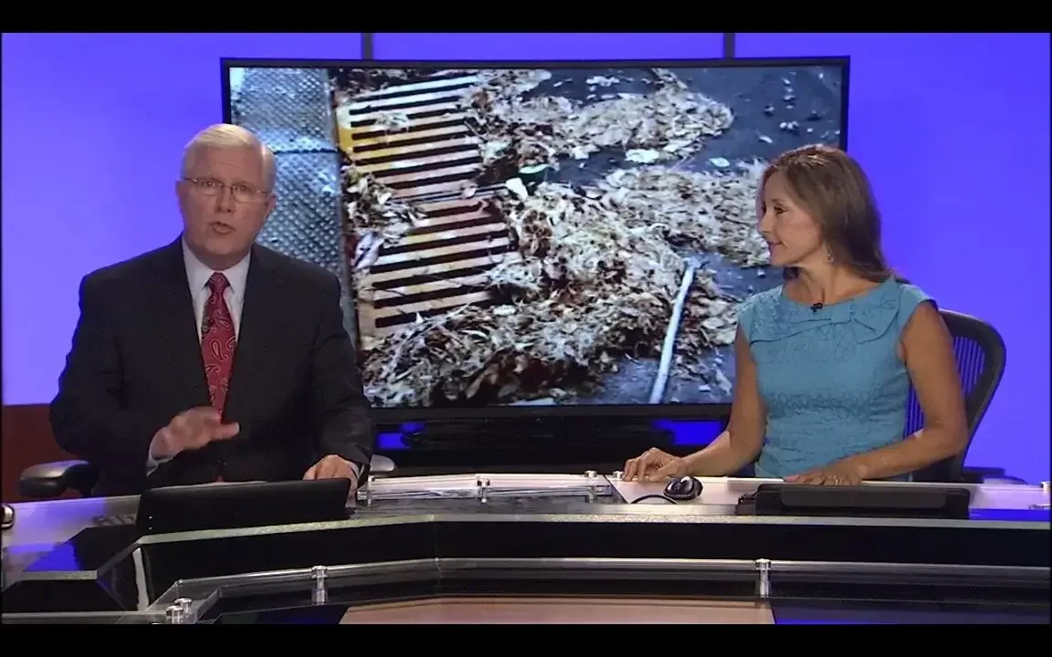
The natural inbound of volunteer support exceeded anything the nonprofit had seen before, and created several years of marketing, media and social media support, too.